Wildlife Management Areas
Prince Edward Island does not have vast expanses of wilderness but areas with high potential for wildlife habitat conservation and management have been designated as Wildlife Management Areas (WMAs) across the Island.
What are Wildlife Management Areas?
Wildlife Management Areas (WMAs) include public and private lands, which have been protected under the Wildlife Conservation Act, and are maintained for the protection, management, and conservation of wildlife and its habitat. Some of these lands also carry the natural areas designation under the Natural Areas Protection Act, restricting certain management activities to protect the area's protected natural features.
How much land is designated as Wildlife Management Areas?
Currently, there are 17 Wildlife Management Areas on Prince Edward Island, ten of them are located on publicly-owned lands.
These lands total about 5,430 hectares (13,420 acres).
Can I hunt, trap or fish in a Wildlife Management Area?
Unless otherwise designated, WMAs are open to consumptive uses such as hunting, fishing, and trapping.
Can I visit the Wildlife Management Areas?
Yes. WMAs are open to hiking, boating, cross country skiing, bird watching, and other non-consumptive uses. Most WMAs are located in eastern or western parts of the province.
| Wildlife Management Area | Community | Special Features |
|---|---|---|
| Dingwells Mills WMA | Dingwells Mills | 480 ha of wetland habitat and black spruce forest |
| Grove Pine/Big Brook WMA | Fortune | 1260 ha along the tidal reaches of the Fortune River |
| Mt. Stewart Marsh WMA | Mt. Stewart | 190 ha of fresh and saltwater marsh along the Hillsborough River |
| St. Chrysostome WMA | St. Chrysostome | 380 ha coastal wetlands and forested area |
For a complete list of all WMAs, contact the Forests, Fish and Wildlife Division at (902) 368-4683
What does the Wildlife Management Area sign look like?
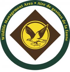
 The Wildlife Management Area sign includes an osprey, a once threatened species, carrying a fish back to feed its young.